Maps from Ships and Secrets
The Known world is a land of icebergs and monsters, kings and queens. These maps chart the paths of my characters and reveal their destinations.
Scroll down for five maps.

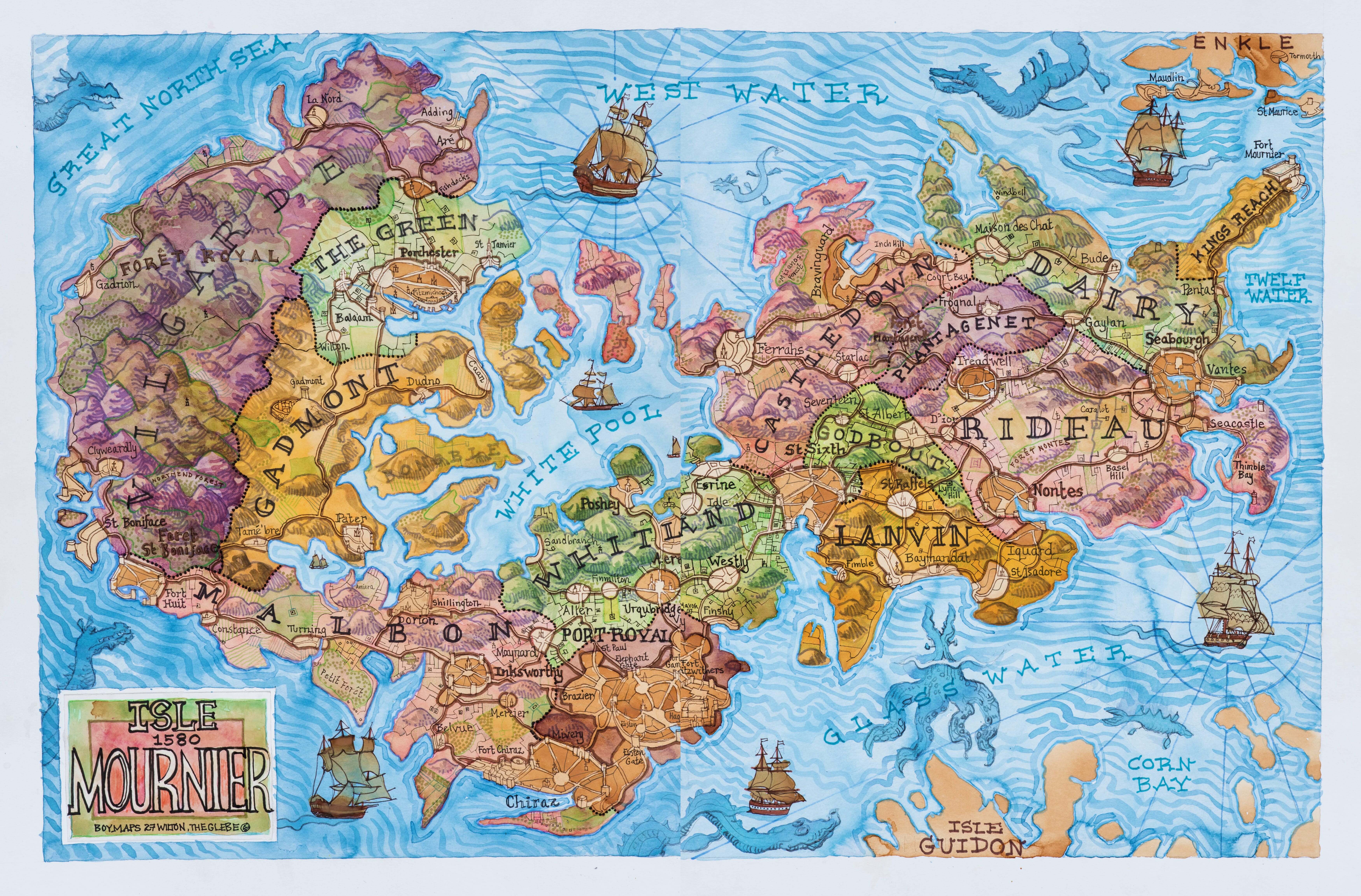
Map 1 | The Isle of Mournier
Home to characters Brunet, Handrew and Margatha, it is one of the four principle islands of the Twelf Archipelago.
This 1580 map shows the 12 counties of the island, including Villgarde in the west where the Royal Forest is located. Lyric Hill, Brunet’s family seat, can be found in County Godbout.
Hover over map or select navigation to explore map in detail .
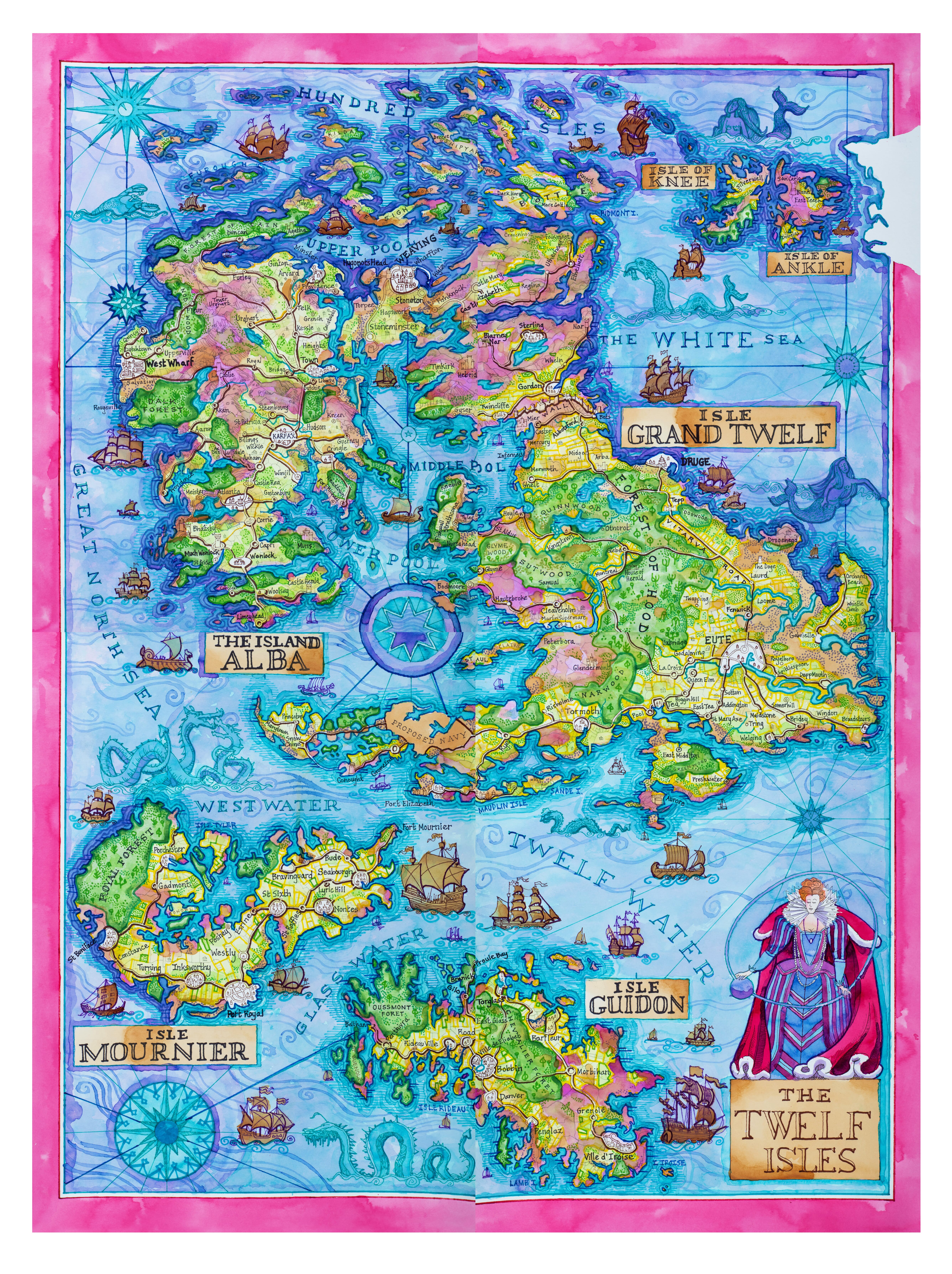
Map 2 | The Twelf Isles
The Islands of Grand Twelf, Alba and Mournier are ruled by Queen Elzibhat from her capital in Eute while the Island of Guidon is occupied by La Manz.
The Queen is depicted here with in an imported silk dress with the world revolving around her.
From the city of Eute, above the Queen’s head on the map, the Vitarva Road can be seen running north to the wall, and beyond to Castle Elizabeth.
Hover over map or select navigation to explore map in detail .
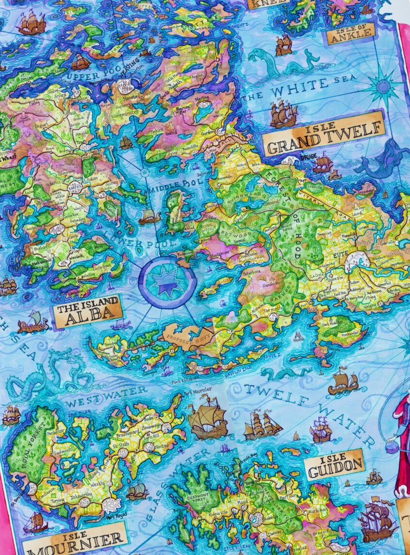
Map 3 | Detailed Map of Grand Twelf & the Island of Alba
This detailed survey map of the two islands was commissioned by the Queen in 1580 and includes Hugonots Head, Elizabeth Castle and the Duchy of Wenlock on the Island of Alba. Although Charters Hill in not surveyed in the principle map, a detailed insert of the City of Eute can be found below the dragons on the right, where the school is clearly marked.
Hover over map or select navigation to explore map in detail .

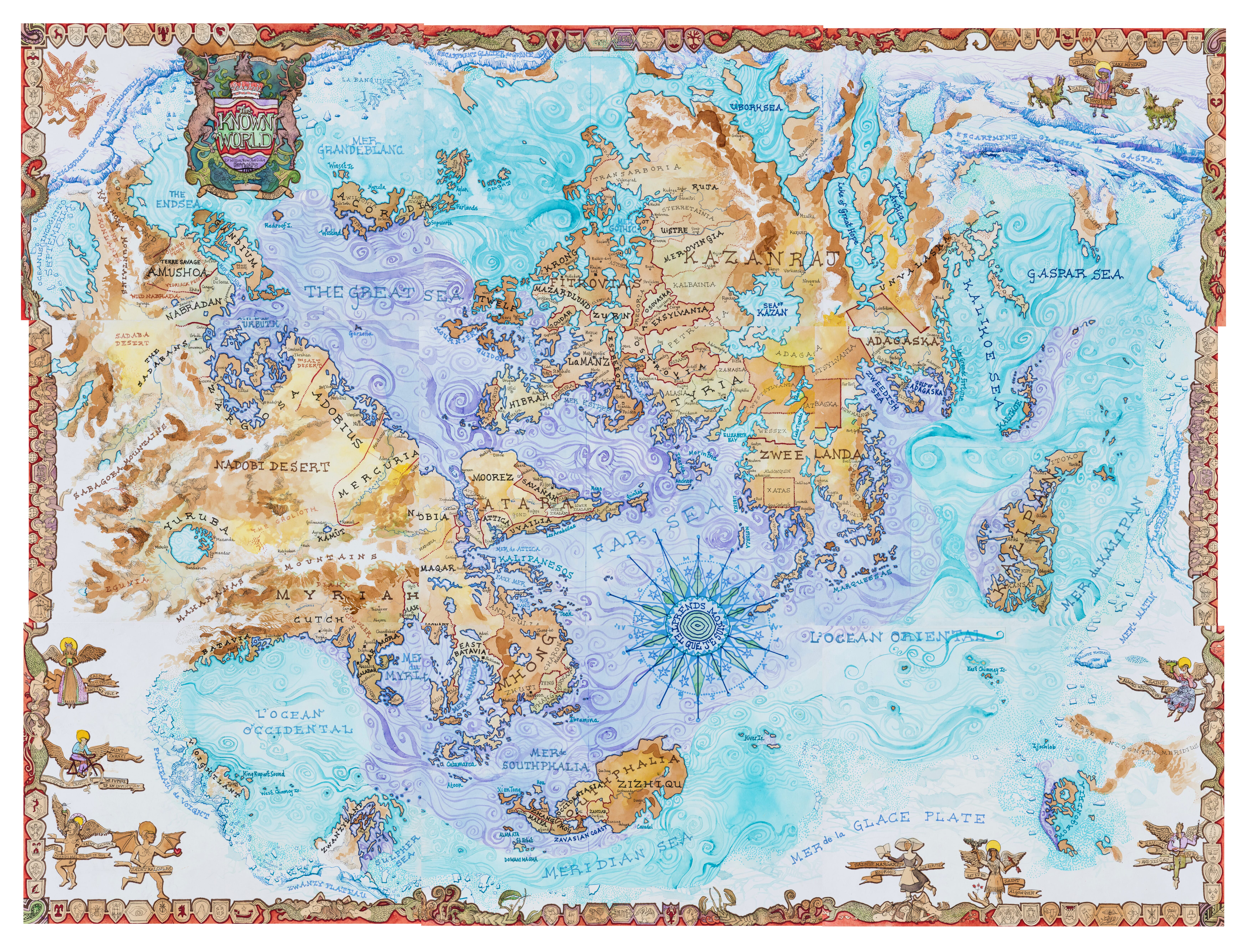
Map 4 | The Known World
This map of the world is typical of charts studied at Charters Hill in the 1580s. The Known World is ringed by mountains and glaciers with the mildest climate in the center. Batavia can be seen on the lower left of the map on the west coast of the Occidental Ocean.
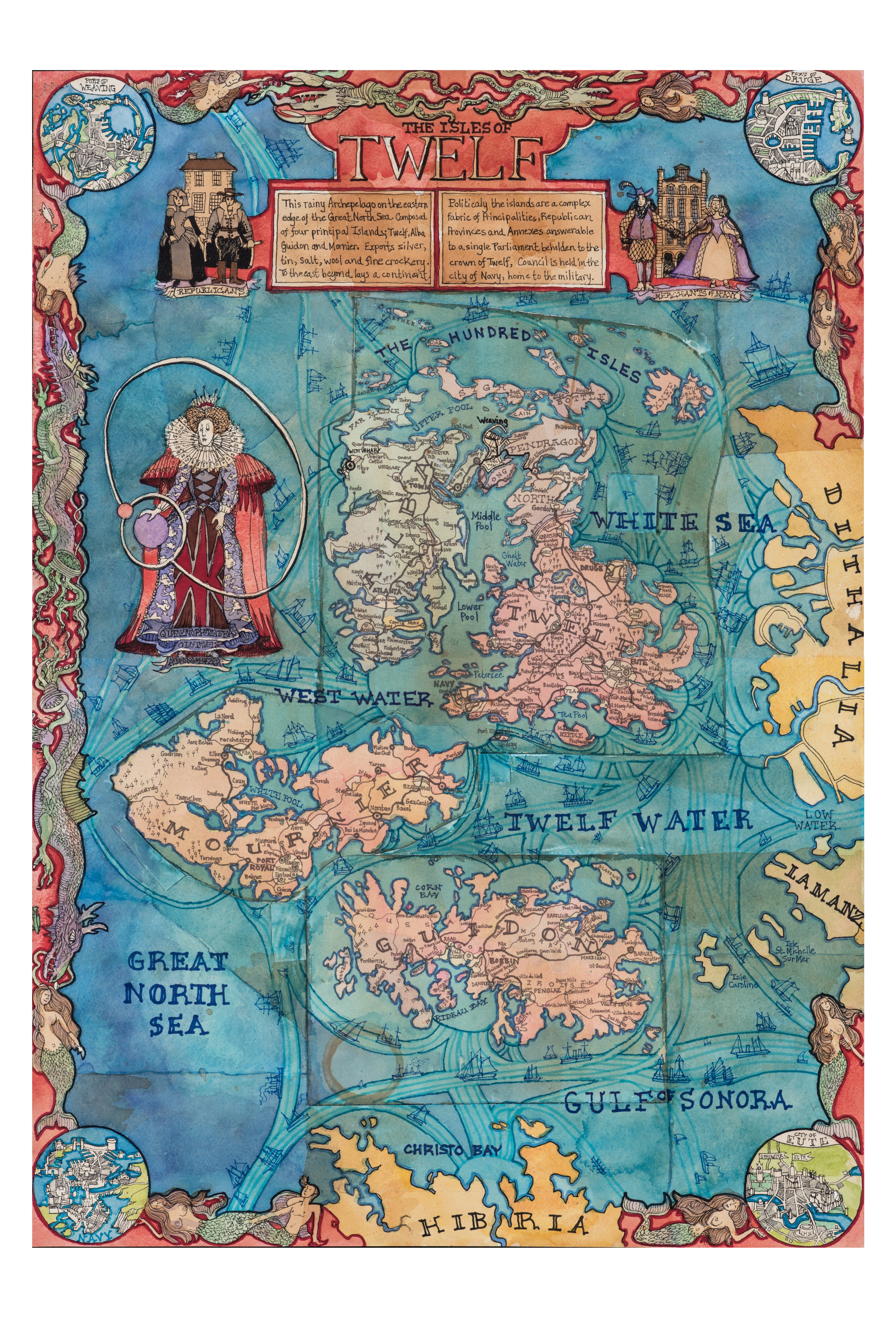
Map 5 | An Olde Map of Twelf Islands
Typical of the charts Captain Herald would have used, this working map from the 1580s has been folded, cut up and pasted back together again. It shows the principle sea routes to continental ports with inserts at the top showing the Ports of Druge and Weaving in great detail.
When Queen Elzibhat first saw this map, she reputedly said it had too many nipples.
Hover over map or select navigation to explore map in detail .